Our “Decision Intelligence” framework leverages the multi-modal fusion of Synthetic Aperture Radar (SAR) and Earth Observation (EO) data. This synergy provides all-weather, day-night monitoring capabilities for critical industries.
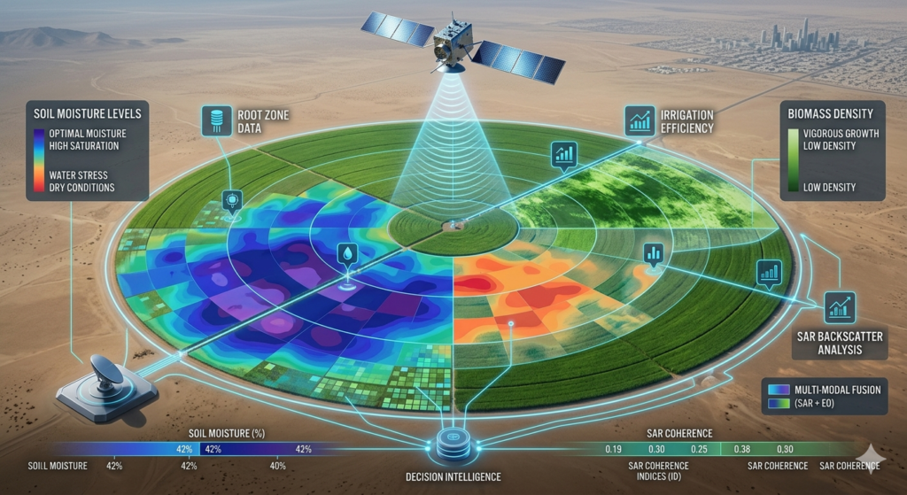
A. Precision Agriculture
Canopy & Soil Analysis: Using SAR for precise soil moisture mapping and biomass estimation regardless of atmospheric conditions.
Spectral Intelligence: Utilizing Hyperspectral EO to detect nutrient deficiencies and early-stage pest stress through chemical signature analysis.
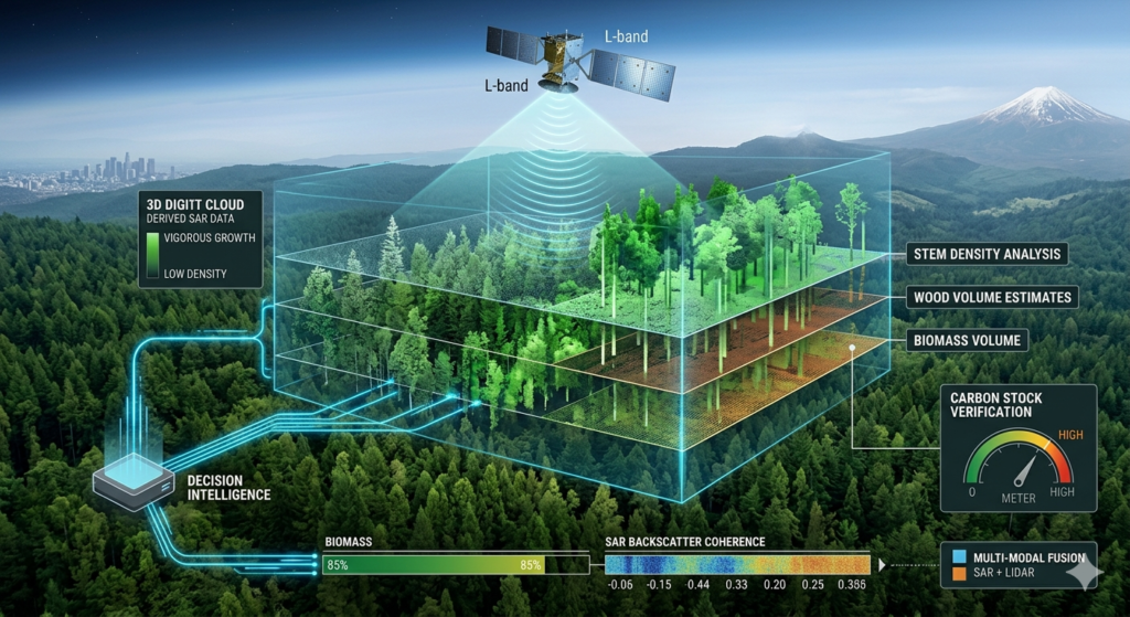
B. Forestry & Carbon Management
3D Structural Mapping: Employing L-band SAR for high-accuracy biomass volume estimation, critical for global carbon stock verification.
Predictive Health Monitoring: Thermal and hyperspectral analysis to identify drought stress and mitigate wildfire risks.
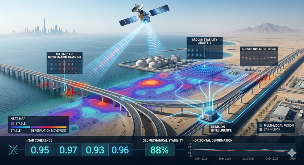
C. Environmental Monitoring & Disaster Response
Geomechanical Stability: Utilizing InSAR for millimetric ground deformation monitoring.
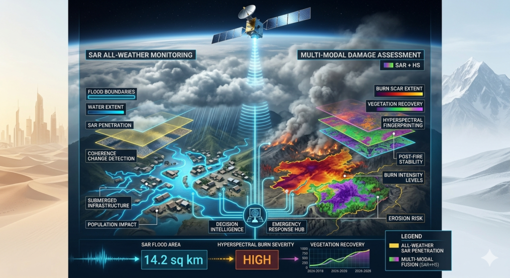
Rapid Crisis Mapping: Providing immediate flood and burn-scar assessments when optical sensors are obscured by cloud or smoke.
D. Mineral Exploration & Earth Elements
We provide professional-grade Spectral Intelligence for the extractive sector, focusing on the identification of critical materials for the global energy transition.
Hyperspectral Mineral Mapping: Mapping surface mineralogical signatures (Lithium, REEs, Copper, Gold, Silver) through SWIR and LWIR absorption bands.
Structural Geology: Linearment and geomorphological analysis to pinpoint hydrothermal alteration zones and potential deposits.
Geotechnical Risk Mitigation: Continuous monitoring of Tailings Storage Facility (TSF) integrity and open-pit stability using interferometric radar.
Environmental Remediation: Monitoring the “Post-Extraction” footprint. EO data tracks the health of surrounding vegetation and local water bodies, ensuring that Mine Rehabilitation efforts meet global sustainability standards.